

County Kent 1829
County Kent 1829
Regular price
£81.00 GBP
Regular price
Sale price
£81.00 GBP
Unit price
per
Tax included.
Shipping calculated at checkout.
Couldn't load pickup availability
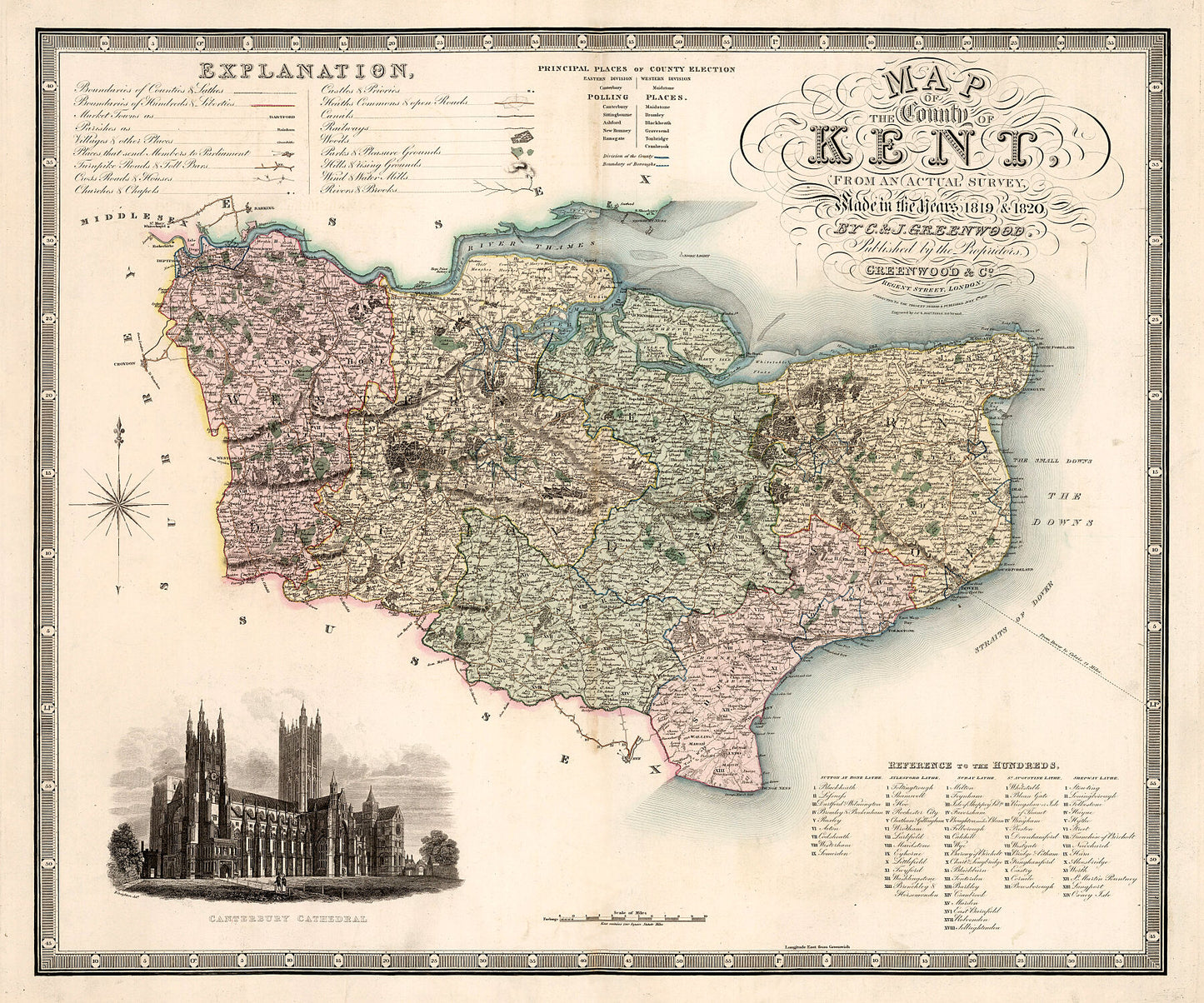
Map of the county of Kent: from an actual survey made in the years 1819 & 1820 ... Corrected to the present period and published July 4h. 1829.
Engraved hand coloured map including an engraved view of Canterbury Cathedral. It shows roads with distances, explanation and compass rose oriented with north to the upper left.
Printed on 290gsm matt smooth Hahnemühle Bamboo. Genuine art paper offering maximum age resistance. Made from 90% bamboo fibre and 10% cotton it combines art with environmental friendliness.
Handmade to order.
All map prints are sent unframed, unless otherwise requested.
Shipping: Royal Mail or Deutsche post.
Find us on Redbubble for more products.